Flood Risk Assessment for Planning
Flood Risk Assessment (FRA) is a critical aspect of sustainable development. It plays a pivotal role in risk management and strategic planning for development projects.
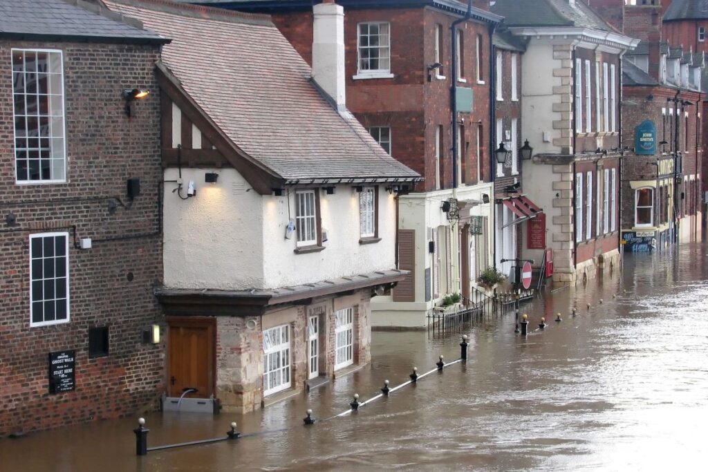
Understanding the potential flood hazards early in the planning process is crucial. This is where strategic flood risk assessments come into play. They help identify these hazards, especially in critical drainage areas.
But it’s not just about rivers. All sources of flooding, including surface water, reservoirs, and groundwater, need to be considered. This comprehensive approach ensures safety and compliance for proposed developments.
Local planning authorities play a key role in this process. They review FRAs submitted with planning applications. The risk of flooding can significantly impact the feasibility and design of a development site.
Click here for an overview of our flood risk and drainage services.
Get Your FREE Quote Today
We are delighted to hear from you and discuss your project requirements. Our team is dedicated to providing a competitive proposal, ensuring the timely delivery of your project for seamless planning success.
Years of Experts' Experience
Consultants
Projects
Deliverables
Efficient & Reliable
Full UK Coverage
UKAS Qualified
Quick Quote
Understanding Flood Risk Assessments for Planning
An FRA is a systematic process. It involves identifying, evaluating, and mitigating potential flood risks. This process is often a requirement for developments in high-risk areas.
The assessment should be detailed and site-specific. It should include data on historical floods, flood defence infrastructure, and the potential impact on the proposed development.
Climate change and its impact on flooding patterns must also be considered. This ensures that the assessment is future-proof and resilient to changing environmental conditions.
Check the long term flood risk of an area in England.
The ultimate goal of the FRA is to ensure the safety of the proposed development and its surrounding community. It aims to prevent or minimize damage from potential flood events.
The Role of Local Planning Authorities in Flood Risk Assessment
Local planning authorities play a crucial role in FRAs. They review the assessments submitted with planning applications.
Their role is to ensure that the proposed developments comply with local and national planning policies. They also verify that the assessments align with the guidelines provided by the Environment Agency.
Local planning authorities can reject planning applications if the FRA are inadequate. Therefore, it’s essential for developers to carry out thorough and accurate assessments.
In addition, they also consider local flood risks. This is especially important in smaller communities where local knowledge can greatly enhance the quality of the assessment.
Identifying and Managing Critical Drainage Areas
Critical drainage areas require special attention in an FRA. These areas are prone to surface water flooding due to inadequate drainage.
Identifying these areas early in the planning process is crucial. It helps in designing effective drainage systems and mitigating potential flood risks.
Addressing critical drainage problems is essential for the resilience of new developments. It ensures that the proposed development can withstand potential flooding events.
In conclusion, managing critical drainage areas is a key aspect of flood risk assessment. It contributes significantly to sustainable development and risk management.
Flood Risk Assessment for Different Zones: Understanding Zone 3a and 3b
FRAs for planning involve understanding different flood zones. Zone 3a, for instance, refers to areas with a high probability of river or sea flooding.
Assessing flood risk for Zone 3a is crucial for any proposed development. It ensures that the development is designed to withstand potential flood events.
Assessing flood risk for Zone 3b ensures the development does not cause a flooding risk to any other areas and is able to securely compensate for the use of the ground.
Local planning authorities often require a comprehensive FRA for developments in Zone 3a. This is to ensure safety and compliance with planning regulations. For Zone 3b, this involves the need for extensive overland flow modelling, the use of predicted flood depth data from the Environment Agency and sustainable design of the drainage system, and the development as a whole.
In conclusion, understanding flood zones like Zone 3a and 3b is a key aspect of the FRA. It helps in making informed decisions about proposed developments.
Find out if you need a flood risk assessment.
Sources of Flooding: Beyond Rivers
When carrying out an FRA, it’s important to consider all potential sources of flooding. This includes not just rivers, but also surface water, reservoirs, and groundwater.
Surface water flooding, for instance, can occur when heavy rainfall overwhelms the drainage system. This is a common issue that needs to be addressed in flood risk assessments.
Reservoirs and groundwater can also pose a flood risk, especially in areas with high water tables or inadequate drainage. These sources of flooding should not be overlooked in the assessment process.
In conclusion, a comprehensive FRA should consider all potential sources of flooding. This ensures a more accurate and effective assessment.
The Impact of Flood Risk on Planning Permission
The risk of flooding can significantly impact the feasibility and design of a development site. It’s a factor that local planning authorities take seriously when reviewing planning applications.
Obtaining planning permission may be contingent on a thorough flood risk assessment. This assessment should demonstrate that flood risks have been assessed and mitigated.
Failure to adequately address flood risks can result in planning permission being denied. This underscores the importance of a comprehensive flood risk assessment in the planning process.
In conclusion, FRAs play a crucial role in securing planning permission for development projects.
How to Carry Out a Flood Risk Assessment
Carrying out a flood risk assessment involves a systematic process. It starts with identifying potential flood hazards associated with the proposed development site.
The next step is evaluating these hazards. This involves assessing the likelihood of flooding and the potential impact on the proposed development.
Mitigation strategies are then developed to manage identified flood risks. These may include installing flood defences or designing sustainable drainage systems.
In conclusion, carrying out a flood risk assessment is a critical step in planning for development. It helps ensure the safety and sustainability of the proposed development.
The Flood Risk Assessment Report: What to Include
A flood risk assessment report is a comprehensive document. It should include data on historical floods and existing flood defence infrastructure.
The report should also assess the potential impact of flooding on the proposed development. This includes both direct damage and indirect consequences such as access issues during flood events.
Mitigation measures proposed to manage identified flood risks should be detailed in the report. This could involve raising building elevations or installing flood barriers.
In summary, a FRA report should provide a clear and detailed picture of flood risks and proposed mitigation strategies. It is a crucial tool in flood risk assessment planning.
Mitigation Strategies: Flood Defences and Surface Water Management
Mitigation strategies are a key part of flood risk assessments for planning. They aim to reduce the impact of potential flooding on a proposed development.
Flood defences are one such strategy. They can include physical barriers, flood-resistant building materials, and elevated structures.
Surface water management is another crucial aspect. This involves designing drainage systems that can effectively handle heavy rainfall and prevent surface water flooding.
In conclusion, both flood defences and surface water management are essential mitigation strategies in flood risk assessments. They help ensure the safety and resilience of developments in flood-prone areas.
The Critical Importance of Flood Risk Assessment in Planning
Flood risk assessment in planning is a critical aspect of sustainable development. It ensures safety, compliance, and resilience in the face of potential flood hazards.
In essence, it’s a proactive approach that safeguards our communities and the environment. It’s a responsibility we all share in the pursuit of responsible development practices.
Government guidance is available.
Flood Risk Assessment FAQs
What is a Flood Risk Assessment (FRA)?
A Flood Risk Assessment (FRA) is a systematic process that involves identifying, evaluating, and mitigating potential flood risks associated with a proposed development site.
Why is Flood Risk Assessment Planning important?
Flood Risk Assessment Planning is crucial as it helps in understanding potential flood hazards early in the planning process, ensuring the safety, compliance, and resilience of developments in flood-prone areas.
Who conducts FRAs?
FRAs are typically conducted by qualified professionals such as environmental consultants, engineers, or hydrologists with expertise in assessing flood risks.
What factors are considered in a FRAs?
Factors considered in a FRA include historical floods, flood defence infrastructure, climate change impacts, potential sources of flooding (rivers, surface water, reservoirs, groundwater), and mitigation strategies.
When is a FRA required?
An FRA is often required for developments in high-risk flood areas or when local planning authorities request it as part of the planning application process.
How does a Flood Risk Assessment impact planning permission?
The findings of a FRA can significantly impact planning permission. Local planning authorities may require thorough assessments to ensure flood risks are adequately addressed before granting permission.
What are critical drainage areas in Flood Risk Assessments for Planning?
Critical drainage areas are locations prone to surface water flooding due to inadequate drainage systems. Identifying and managing these areas are essential for effective FRA planning.
What is Zone 3a in flood risk assessment?
Zone 3a refers to areas with a high probability of river or sea flooding. Understanding and assessing flood risks in Zone 3a are crucial for designing developments that can withstand potential flood events.
What should a FRA report include?
An FRA report should include data on historical floods, existing flood defence infrastructure, potential impact on the proposed development, and detailed mitigation strategies to manage identified flood risks.
How can developers improve the quality of Flood Risk Assessments?
Developers can improve the quality of FRAs by working closely with qualified professionals, considering all potential sources of flooding